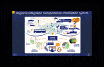
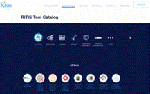
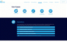
RITIS (Regional Integrated Transportation Information System) is a platform that consolidates transportation-related data from multiple agencies, standardizes it, fuses it, and makes it available both in real-time and in historic analytics. RITIS provides a broad spectrum of advanced analytics – from comprehensive situational awareness to in-depth archived data evaluation (via the Probe Data Analytics Suite) – for public agencies and organizations looking to optimize roadway operations, conduct extensive planning and make smart project & programming decisions. There are also catalogs of Tutorials and Report Templates, along with various Use Cases to make your use of the tools fast and easy, with professional, informative, and easy-to-understand results.
The RITIS User Group
Dozens of agencies participate in regular RITIS User Group meetings to share best practices, hear about the latest features & functions from the CATT Lab and exchange thoughts and ideas for improving the tools. User Group members have gained particular benefit and insight from spotlight presentations by their peers, that showcase the power of using the tools for a variety of use cases – Project Assessment, After Action Reviews, System Monitoring and Management and much more.
Meeting information from previous meetings
- July 25, 2024 | RITIS & Probe Data Analytics Suite User Group Web Meeting
-
May 7, 2024 | RITIS & Probe Data Analytics Suite User Group Web Meeting
-
February 1, 2024 | RITIS & Probe Data Analytics Suite User Group Web Meeting
-
October 19, 2023 | RITIS & Probe Data Analytics Suite User Group Web Meeting
-
July 27, 2023 | RITIS & Probe Data Analytics Suite User Group Web Meeting
-
May 4, 2023 | RITIS & Probe Data Analytics Suite User Group Web Meeting
-
February 2, 2023 | RITIS & Probe Data Analytics Suite User Group Web Meeting
-
October 20, 2022 | RITIS & Probe Data Analytics Suite User Group Web Meeting
-
July 28, 2022 | RITIS & Probe Data Analytics Suite User Group Web Meeting
-
May 5, 2022 | RITIS & Probe Data Analytics Suite User Group Web Meeting
- February 24, 2022 | RITIS & Probe Data Analytics Suite User Group Web Meeting
- September 30, 2021 | RITIS & Probe Data Analytics Suite User Group Web Meeting
- July 15, 2021 | RITIS & Probe Data Analytics Suite User Group Web Meeting
- May 20, 2021 | RITIS & Probe Data Analytics Suite User Group Web Meeting
- February 11, 2021 | RITIS & Probe Data Analytics Suite User Group Web Meeting
- October 1, 2020 | RITIS & Probe Data Analytics Suite User Group Web Meeting
- May 7, 2020 | RITIS & Probe Data Analytics Suite User Group Web Meeting
- February 6, 2020 | RITIS & Probe Data Analytics Suite User Group Web Meeting
- October 3, 2019 | RITIS & Probe Data Analytics Suite User Group Web Meeting
- July 25, 2019 | RITIS & Probe Data Analytics Suite User Group Web Meeting
- Presentation with Audio (not complete recording)
- Slides only
- Q & A Summary
- April 25, 2019 | RITIS & Probe Data Analytics Suite User Group Web Meeting
- February 14, 2019 | RITIS & Probe Data Analytics Suite User Group Web Meeting
- October 25, 2018 | RITIS & PDA Analytics Suite User Group Web Meeting
- July 19, 2018 | RITIS & Probe Data Analytics Suite User Group Web Meeting
- March 8, 2018 | Probe Data Analytics Suite User Group Web meeting
- January 18, 2018 – RITIS User Group Web meeting
- December 14, 2017 | Probe Data Analytics Suite User Group Web meeting
- September 21, 2017 – RITIS User Group Web meeting
- August 18, 2017 | Probe Data Analytics User Group Web meeting
- June 8, 2017 – RITIS User Group Web Meeting
- May 11, 2017 | Probe Data Analytics User Group Web meeting
- March 9, 2017 – RITIS User Group Web Meeting
- February 9, 2017 | Probe Data Analytics User Group Web meeting
- Presentation
- Meeting Notes
- Spotlight Presentation with audio: Visual Exploration of GPS Traces, UMD CATT
- December 15, 2016 – RITIS User Group Web Meeting
- November 17, 2016 | Probe Data Analytics (VPP Suite) User Group Webcast
- July 28, 2016 | VPP Suite User Group Webcast
- April 21, 2016 | VPP Suite User Group Webcast
- January 20, 2016 | VPP Suite User Group Webcast
- October 13, 2015 | VPP Suite User Group Webcast
- July 15, 2015 | VPP Suite User Group Webcast
- April 8, 2015 | VPP Suite User Group Webcast
- September 24, 2014 | VPP Suite User Group
- June 6, 2014 | VPP Suite User Group
- Presentation, Assessment Summary created by NJDOT
- October 15, 2013 | VPP Suite User Group
RITIS User Group Follow-Up – May 2024
RITIS User Group Follow-Up – February 2024
RITIS User Group Workshop Follow-Up – December 2023
RITIS User Group Follow-Up – November 2023
RITIS User Group Follow-Up – July 2023
RITIS User Group Updates – April 2023 – May 2023
RITIS User Group Follow Up – February 2023
RITIS Workshop #3 – Creating an After-Action Report Follow-Up – December 2022
RITIS User Group Follow Up – October 2022
RITIS User Group Follow Up – July 2022
RITIS User Group Updates – March 2022 – May 2022
RITIS User Group Follow Up – February 2022
RITIS User Group Follow Up – September 2021
RITIS User Group Follow Up – July 2021
RITIS User Group Follow Up – May 2021
RITIS User Group Follow Up – February 2021
RITIS User Group Follow Up – October 2020
RITIS User Group Follow Up – May 2020
RITIS User Group Follow Up – February 2020
RITIS User Group Follow Up – October 2019
RITIS User Group Follow Up – July 2019
RITIS User Group / PDA Suite User Group Follow-Up – May 2019
RITIS User Group / PDA Suite User Group Follow-Up – March 2019
RITIS User Group / PDA Suite User Group Follow-Up – November 2018
PDA Suite User Group Newsletter – Fall 2018
RITIS User Group / PDA Suite User Group Follow-Up – July 2018
RITIS User Group / PDA Suite User Group Follow-Up – February 2018
RITIS User Group Follow-Up – October 2017
Probe Data Analytics Newsletter – August 2017
RITIS User Group Update – June 2017
Probe Data Analytics Newsletter – May 2017
Probe Data Analytics User Group Update – February 2017
Probe Data Analytics Newsletter – February 2017
VPP/VPP Suite Newsletter – November 2016
VPP-VPP Suite Newsletter – October 2016
VPP/VPP Suite Newsletter – Summer 2016
VPP/VPP Suite Newsletter – March 2016
VPP/VPP Suite Newsletter – February 2016
Workshops
-
RITIS Workshop: Exploring Probe Data Analytics Suite Tools and the Updated Volume Estimation Models That Drive Them – March 19, 2024
- What’s New with PDA & RITIS Tools – RITIS Workshop #5 – December 5, 2023
- Trips Analytics – RITIS Workshop #4 – April 20, 2023
- Creating an After-Action Report – RITIS Workshop #3 – November 17, 2022
- Understanding Origin-Destination Data: RITIS Workshop #2 – April 8, 2022
- Building a Corridor Performance Summary Report: RITIS Workshop #1 – March 29, 2022
PDA Suite Focus Groups
- O-D Data Suite Focus Group
- June 16, 2017 | Inaugural Meeting